News Summary
Residents in the Tennessee Valley are on high alert as moderate to heavy rain is forecasted, raising the likelihood of flooding. The Weather Authority has issued an Impact Day alert and areal flood warnings for several counties. As rain continues to accumulate, the risk of impassable roads and dangerous conditions increases, prompting officials to advise caution. Residents are urged to stay informed and prepare for possible evacuations while keeping safety as the top priority.
Flooding Concerns Increase in the Tennessee Valley
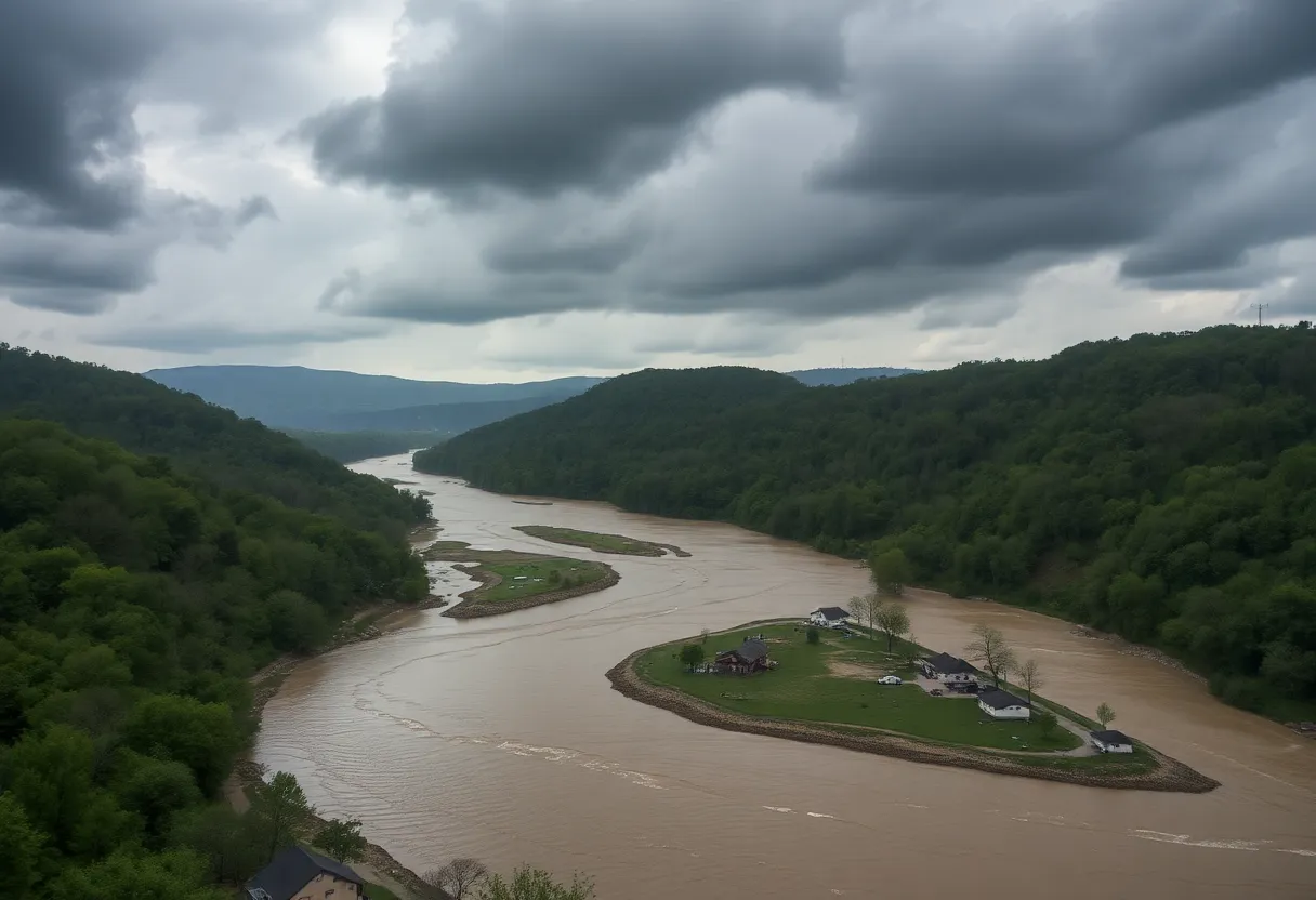
As the clouds gather and the rain continues to pour, residents in the Tennessee Valley are keeping a close eye on possible flooding concerns. A series of moderate to heavy rain bands are moving into the area, and with that, the threat of flooding is rising.
Weather Authority Impact Day Alerts
Starting Wednesday, the Weather Authority will designate an Impact Day due to an increased risk of flooding. So, what does this mean for you? Well, if you’re living in or around the Tennessee Valley, it’s time to take those rain boots out!
Areal Flood Warnings Issued
An Areal Flood Warning is currently in effect for areas along and west of I-65 until 9 p.m. on Tuesday night. Counties included in this advisory are Colbert, Franklin, Lauderdale, Lawrence, western Limestone, and western Morgan. If you’re in these areas, be vigilant.
But wait, there’s more! A second warning affects eastern Limestone, Franklin (TN), Jackson, Lincoln, Madison, and Moore counties, also lasting until 9 p.m. on Tuesday. To say it’s “rainy season” would be an understatement!
Roads, Low-Lying Areas in Trouble
As the rain continues, low-lying areas and roadways could become flooded or impassable. Particularly in Lauderdale County, many roads have already been closed due to adverse conditions. Flooding is also occurring in some low-lying areas east of I-65, especially in Jackson County. It’s becoming crucial for all residents to take extra care while navigating these areas.
Rainfall Totals on the Rise
The past 24 hours have seen rainfall totals ranging from a steady 0.75 inches to an impressive over 2.50 inches. And the reliable forecast suggests that rain isn’t done with us just yet! Overnight and into Wednesday, more rain is predicted to fall, which means we may see even more flood alerts popping up.
Be Prepared, Stay Safe
Residents are encouraged to be prepared with multiple ways to receive weather alerts. One helpful suggestion is to download an alert app to get real-time updates and radar notifications. When it comes to flooding, safety is paramount, so remember: never drive through flooded roadways! If it looks dangerous, it probably is.
Be ready to evacuate to higher ground if necessary, as these storms can produce not just heavy rainfall but also strong winds and lightning. It’s critical to keep yourself and your loved ones safe during these unpredictable weather events.
The Weather Forecast
Looking ahead, showers will not only linger but are expected to last into Wednesday, with thunderstorms likely making their appearance after 3 p.m. High temperatures will reach around 65°F likely accompanied by wind gusts of up to 20 mph. That means it might feel a bit blustery out there, so it’s best to bundle up!
Forecasts also predict that rainfall totals could exceed one inch, especially in flood-prone areas. By Wednesday night, there’s a whopping 90% chance of precipitation continuing, indicating that we are not out of the woods yet.
Drivers are advised to exercise caution, especially as roads may become slick and visibility may be reduced while rain falls. Plan your trips accordingly and allow extra time to get to your destination safely.
What’s Next?
Looking beyond the rain, Thursday is expected to bring a brighter outlook with mostly sunny weather and a high around 51°F. However, it’ll be chilly overnight, dropping to about 28°F. Friday is promising warmer temperatures, reaching 58°F, but don’t let your guard down—another round of rain may arrive late Friday into Saturday.
So, stay tuned to your local forecasts and prepare for potential travel delays or outdoor disruptions. Keep your spirits up and don’t forget—this is just another chapter in the ever-changing Tennessee Valley weather saga!
Deeper Dive: News & Info About This Topic
HERE Resources
Huntsville Prepares for Upcoming Winter Storm
Additional Resources
- Country Herald: Alabama Braces for Heavy Rain
- Wikipedia: Main Page
- WAAY TV: Don’t Freak Out Yet
- Google Search: Flooding Tennessee Valley
- WHNT: Gateway Place Residents Still Displaced
- Encyclopedia Britannica: Flood
- KBTX: City of Huntsville Declares Disaster
- Google News: Flooding Huntsville

Author: STAFF HERE HUNTSVILLE WRITER
The HUNTSVILLE STAFF WRITER represents the experienced team at HEREHuntsville.com, your go-to source for actionable local news and information in Huntsville, Madison County, and beyond. Specializing in "news you can use," we cover essential topics like product reviews for personal and business needs, local business directories, politics, real estate trends, neighborhood insights, and state news affecting the area—with deep expertise drawn from years of dedicated reporting and strong community input, including local press releases and business updates. We deliver top reporting on high-value events such as Panoply Arts Festival, Rocket City Brewfest, and Huntsville Comic & Pop Culture Expo. Our coverage extends to key organizations like the Huntsville/Madison County Chamber of Commerce and HudsonAlpha Institute for Biotechnology, plus leading businesses in aerospace, defense, and manufacturing that power the local economy such as Boeing, SAIC, and Mazda Toyota Manufacturing. As part of the broader HERE network, including HEREBirmingham.com, we provide comprehensive, credible insights into Alabama's dynamic landscape.